GRWC Monitoring Program
 The GRWC Monitoring Program is designed to examine and understand watershed conditions through the collaboration of private landowners, community groups and public agencies.
Check out the Gualala River Watershed Blog to see what's currently happening out in the watershed.
Reach Surveys
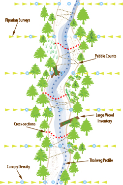
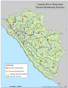
Over the past decade the GRWC has installed thirty-five (35) monitoring reaches within the watershed. These sites are at a minimum 1,000 feet long and range up to 2,500 feet in the larger tributaries.
At these sites throughout the watershed the GRWC surveys thalweg elevations, cross-section elevations, riparian vegetation, canopy density, substrate size and composition, water and air temperature, and instream large wood abundance.
Over the next decade the GRWC will install an additional 35 monitoring sites (for a total of 70 throughout the watershed) and continue to re-survey existing sites on a rotational basis. Four reaches have been designated as reference reaches and are surveyed on an annual basis.
Water and Air 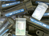 Temperature
Water temperature is one of the most important factors in the health of stream ecosystems and the fish they support.
Temperature affects salmonid egg and fry incubation, fish metabolism, resistance to disease, and availability of oxygen and nutrients.
Different species of salmonids have evolved to utilize different thermal regimes, although there is overlap.
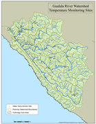
The GRWC currently has 110 temperature water and air monitoring sites throughout the watershed with temperature data dating back to 1992.
Sites are distibuted throughout the watershed in both mainstream reaches and tributaries (see map). Approximately 30 to 40 water and air temperature sites are monitored every low flow season.
 Flow
Flow
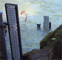
Two flow gauges are currently USGS certified and on-line in the Gualala; the South Fork gauge on the South Fork below the confluence of the Wheatfield Fork and the North Fork Gauge on the North Fork below the Little North Fork confluence.
Stream gauges serve multiple uses. Our gauges provide useful information relating to water diversions, water quality monitoring, and floodplain mapping. Gauge data are included in making decisions related to water supply, regulatory oversight of water diversions, regulatory rules concerning flood plains and riparian buffers, water quality, watershed management, restoration effectiveness, research, fishing, and water based recreation.
Currently the South Fork gauge is fully operational and can be accesssed for real-time data at the USGS website. The North Fork gauge is operated for Partial Range Stream flow (seasonal low water) meaning the USGS website reports stage all year long but discharge is limited to below 400cfs.
The South Fork gauge is funded by the GRWC by contributions from landowners and matching funds from USGS. Contributors include Gualala Redwoods, Inc., Kendall Jackson Winery, Mendocino Redwood Company and The Sea Ranch Water Company. The North Fork gauge is funded by the North Gualala Water Company.
This past year, with the help of Mike Webster from USGS, we have re-activated a gauge on the Wheatfield Fork. It will not be on-line or USGS certified but it will provide us with valuable data regarding surface flows in the Wheatfield Fork.
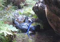 Snorkel Surveys
Snorkel surveying is the underwater observation and study of fish in flowing waters.
By collecting these types of data we can assess the presence or absence of different aquatic species within the watershed.
Snorkel surveys also provide us with specific data on juvenile salmonid populations, allowing us to analyze both relative and total abundance, fish distribution, species assemblages (diversity), stock characteristics (length estimation), and habitat use.
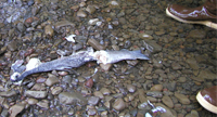 Spawning Surveys
The purpose of spawning surveys is to determine the distribution and abundance of salmonids spawning in the watershed. The surveys expand our knowledge of spawner numbers, timing and location, and types of species.
Spawning surveys are conducted in the winter and spring months and in the Gualala are dependent on the opening of the estuary. The GRWC follows the California Department of Fish and Game spawning protocol developed by Sean Gallagher and Morgan Knechtle.
Maps
GRWC Temperature Sites
 8.5x11 inches PDF
GRWC Monitoring Reach Sites
 8.5x11 inches PDF